
Gerlerkogel, von der Teichalm
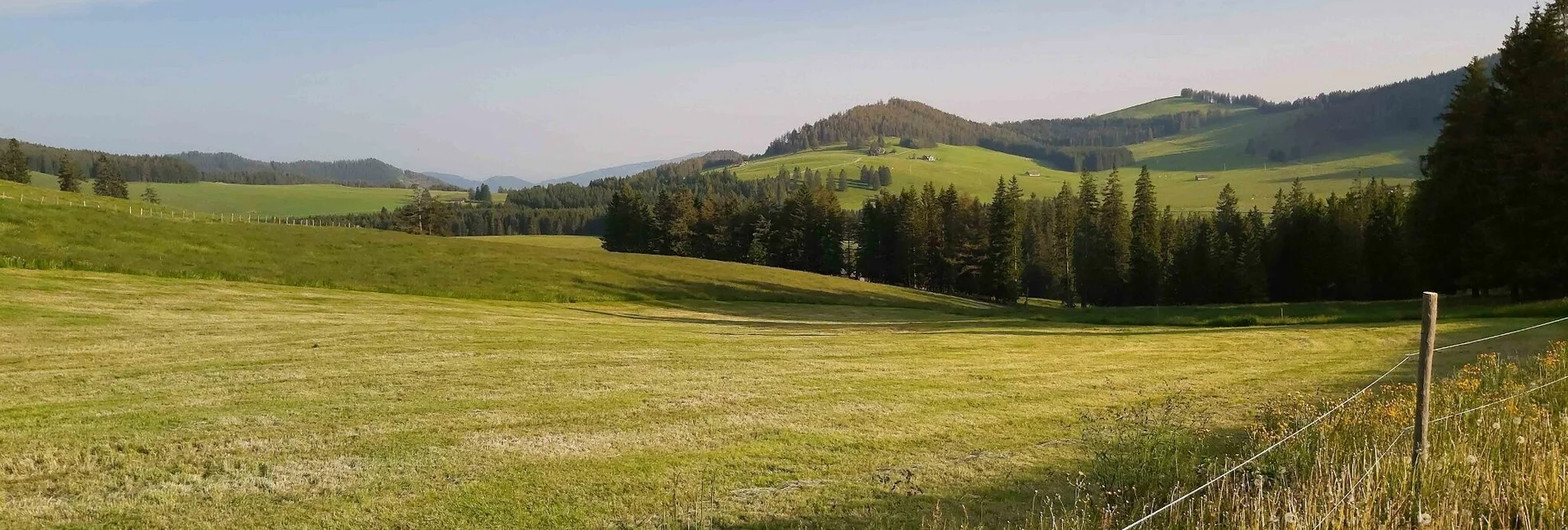
OpenDie Tour startet auf der Breitalm und führt zuerst hinunter zum Teichalmsee. Von dort geht es rechts sanft hinauf in Richtung Gerlerkogel, der Weg führt aber tatsächlich um den Gerlerkogel herum, wer möchte kann natürlich den kurzen Weg hinauf zum Gipfel gehen und hat dann einen schönen Rundblick. Direkt am Weg liegt die neue Gerlerkogelhütte, die mit ihrem Ausblick perfekt für eine Rast ist. Der weitere Weg führt jetzt vorbei am Gerlerkreuz wieder hinunter auf die Teichalm.
Gleich bei der Latschenhütte ist der Zugang zum wildromantischen Teichalmmoor, das durchwandert werden kann. Der Weg endet am See beim Holzochsen, der die Rindfleisch-Region Almenland repräsentiert. Am See warten Tretboote für eine kleine Rundfahrt und außerdem gleich mehrere Gastbetriebe für eine Einkehr. Der restliche Weg führt jetzt vorbei am Holzochsen hinauf zum Hotel Pierer und wieder zurück zur Breitalm, am Fuße des Heulantsch.
ACHTUNG: Das Teichalmmoor ist im Winter gesperrt, die Öffnung des Weges ist für den 1. Mai 2021 geplant!
Characteristics
Best season
The tour in numbers
Map & downloads
More information
Zu Google Maps für die Berechnung der Anreise.
- Wir starten beim Parkplatz oberhalb vom Hotel Pierer und gehen hinunter zum Hotel.
- Gleich nach dem Hotel biegen wir rechts hinunter in den Weg-Nr. 27 hinunter zum Teichwirt bzw. See ein.
- Zwischen dem Hotel Teichwirt und der Skischule Reisinger erreichen wir den See, wir gehen den See entlang bis zum Bootsverleih.
- Dort biegen wir auf den anderen Straßenseite rechts hinauf in den Weg-Nr. 740 ein und gehen in hinauf in Richtung Gerlerkogel.
- Wir orientieren uns an den Wegtafeln zur Gerlerkogel-Hütte, die wir nach einer letzten Abzweigung links hinauf erreichen.
- Der weitere Weg führt links an der Hütte vorbei den Berg hinauf, bald sehen wir links den Gerlerkogel und rechts das "Gerlerkreuz".ö
- An der Weggabelung halten wir uns links und gehen weiter in Richtung Teichalm zurück zum See.
- Am See angekommen wir rechts den See entlang zur Latschenhütte, gleich daneben ist der Eingang zum Teichalmmoor.
- Die Runde durch das Moor endet wieder am See, hinter dem Holzochsen steigen wir hinauf zum Hotel Pierer.
- Beim Hotel halten wir uns rechts und erreichen bald wieder den Parkplatz.
Der Lärchenplanken-Weg durch das Teichalm-Moor, eines der letzten Hochmoore der Steiermark, wurde komplett neu gestaltet und mit mehreren Rastplätzen versehen.
Fahrpläne und Reiseinformationen finden Sie bei den Österreichischen Bundesbahnen (ÖBB) oder auf www.busbahnbim.at.
Mit der BusBahnBim App der Verbundlinie ist eine Fahrplanauskunft so einfach wie noch nie: Alle Verbindungen mit Bus, Bahn und Straßenbahn in Österreich können durch die Eingabe von Orten und/oder Adressen, Haltestellen bzw. wichtigen Punkten abgefragt werden. Erhältlich ist die App als Gratis-App für Smartphones (Android, iOS) – auf Google Play und im App Store.
Für den örtlichen Transport empfehlen wir das SAM-SammelTaxi, alle Informationen dazu finden Sie hier.
Weitere Infos zur Region, wo Sie einkehren können, wo es Zimmer gibt und wo Sie die Beschreibung der Ausflugsziele und Betriebe finden:
Tourismusverband OststeiermarkGeschäftsstelle Naturpark AlmenlandFladnitz 1008163 Fladnitz/TeichalmTel: +43 3179 23000Mail: almenland@oststeiermark.comwww.almenland.at | www.oststeiermark.com
Wanderkarte "Almenland", freytag & berndt, 1:50 000 - erhältlich im Almenland-Tourismusbüro oder bei den Betrieben,
Wanderkarte "Grazer Bergland - Schöckl - Teichalm - Stubenbergsee", freytag & berndt, 1:50 000, erhältlich im Buchhandel.
Almenland-Wanderführer, erhältlich im oder bei den Betrieben.


